Looking for fresh air, an easy place to walk the dog, or a weekend hike without a long drive? Living near Serrano Summit puts you minutes from neighborhood greens, regional bike paths, and some of Orange County’s best trail systems. Whether you want a toddler‑friendly playground and a stroller loop or a longer cardio climb, you have options close to home.
This guide highlights nearby parks and trail areas, what to expect, and simple planning tips for a smooth outing. You will find quick-read park cards, route ideas, and links to official sources for current rules and alerts. Let’s dive in.
How to pick your perfect park day
Choosing the right spot is easier when you match the park to your goal. Here is a quick way to narrow it down.
- Families with young kids: Look for neighborhood or community parks with playgrounds, shade, and restrooms. Short paved paths keep things simple.
- Dog walks: Start with multi‑use greenbelts and regional paths. Always check leash rules on the official park page before you go.
- Cardio and trail runs: Target regional parks and wilderness areas with loop options. Early starts help you avoid heat and crowds.
- Mountain biking: Choose designated multi‑use trail systems and confirm permitted uses and current status on official sites.
Pack the basics: water, sunscreen, hat, snacks, and a small first‑aid kit. In summer, carry at least 1 liter of water per adult per hour for longer hikes. When it is hot, aim for morning or late afternoon.
Neighborhood and community parks nearby
These everyday parks work well for quick outings, short walks, and family time.
Lake Forest Sports Park
- Category: Neighborhood park
- Distance from Serrano Summit: About 5–10 minutes by car
- Best for: Families, casual walks, and open green space
- Key routes: Short paved walking paths around fields and community areas
- Amenities: Open lawns, community facilities, and multi‑use spaces
- Parking: On‑site lots; arrive early on busy weekends during events
- Access notes: Check the city’s page for hours, amenities, and rules
- Safety & seasonality: Expect warmer temps mid‑day in summer; bring water
- Map pin: Lake Forest
- Source: Learn more on the City of Lake Forest Parks & Recreation website under parks and facilities at the City of Lake Forest site
The city maintains up‑to‑date details on hours, park use, and any scheduled events. Visit the City of Lake Forest Parks & Recreation pages through the City of Lake Forest site for the latest information.
Serrano Creek Park and Greenbelt
- Category: Neighborhood park / greenway
- Distance from Serrano Summit: About 5–10 minutes by car
- Best for: Dog walks, stroller‑friendly strolls, and relaxed jogs
- Key routes: Paved and hard‑packed paths along the creek corridor
- Amenities: Greenbelt segments, shade in some areas, and benches
- Parking: Nearby street parking or small lots depending on your access point
- Access notes: Verify trail segments, hours, and any posted rules with the city
- Safety & seasonality: Watch for cyclists on multi‑use sections; carry water
- Map pin: Lake Forest
- Source: Check the City of Lake Forest Parks & Recreation information via the City of Lake Forest site
Heritage Hill Historical Park
- Category: Neighborhood park with historical grounds
- Distance from Serrano Summit: About 10 minutes by car
- Best for: A relaxed stroll paired with a cultural stop
- Key routes: Short walks around the historic grounds and lawns
- Amenities: Green space and historic features with seasonal programming
- Parking: On‑site lot; hours vary by schedule and programming
- Access notes: Confirm hours and any special events before you go
- Safety & seasonality: Midday heat can build; plan shade and water
- Map pin: Lake Forest
- Source: For regional park details and updates, refer to OC Parks
Regional trails and greenways
These areas offer longer walks, easy bike rides, and accessible trailheads fit for family weekends.
Aliso Creek Bikeway and Greenbelt access points
- Category: Regional multi‑use trail
- Distance from Serrano Summit: Around 10–15 minutes by car to common access points
- Best for: Casual cycling, family rides, and long stroller‑friendly walks
- Key routes: Choose out‑and‑back mileage that fits your time
- Amenities: Multi‑use path with periodic rest stops and cross‑street access
- Parking: Use public lots near community parks or street parking at trail access points
- Access notes: Check local city or OC Parks resources for permitted uses and hours
- Safety & seasonality: Expect cyclists and runners; use the right side, announce passes
- Map pin: Varies by access point across south Orange County
- Source: Find regional context and rules at OC Parks
Peters Canyon Regional Park
- Category: Regional park
- Distance from Serrano Summit: Typically 20–30 minutes by car depending on traffic
- Best for: 1–2 hour loops, trail runs, and scenic cardio
- Key routes: Popular loop options with rolling hills
- Amenities: Trail network, scenic overlooks
- Parking: On‑site lots; weekends can fill early
- Access notes: Check hours, parking fees if any, and current conditions before you go
- Safety & seasonality: Expect sun exposure and warm temps; carry water and wear a hat
- Map pin: Tustin area
- Source: Review park details and alerts at OC Parks
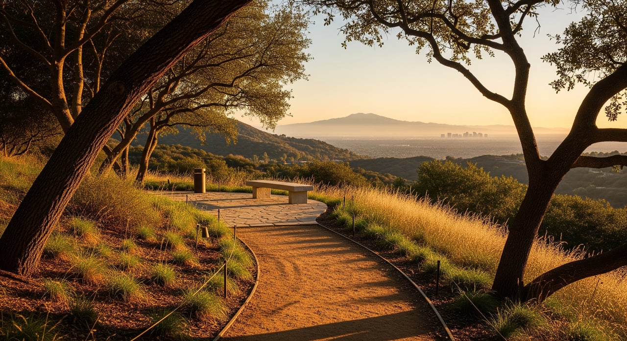
Wilderness hikes and MTB favorites
Ready for dirt under your shoes or tires? These preserves are go‑tos for longer hikes, trail runs, and mountain biking. Always check official pages for permitted uses, current conditions, and any reservation requirements.
Whiting Ranch Wilderness Park
- Category: Wilderness preserve
- Distance from Serrano Summit: About 15 minutes by car under normal conditions
- Best for: Hikes, runs, and designated mountain bike routes
- Key routes: Multiple loops on dirt singletrack and wider trails
- Amenities: Trailhead parking at several access points
- Parking: Lots can fill on weekends; arrive early and have a backup trailhead
- Access notes: Confirm hours, permitted use, and any closures before heading out
- Safety & seasonality: Heat, wildlife, and periodic fire‑related closures are possible
- Map pin: Foothill Ranch area
- Source: Check official updates and park info at OC Parks
Irvine Ranch Natural Landmarks (Bommer Canyon, Quail Hill, and more)
- Category: Conservancy‑managed open space
- Distance from Serrano Summit: About 15–25 minutes by car to common trailheads
- Best for: Guided hikes, stewardship days, and designated self‑guided routes
- Key routes: Options range from short interpretive walks to longer hill loops
- Amenities: Trailheads with posted maps at select locations
- Parking: Use posted lots or street parking where signed
- Access notes: Some areas require reservations or are available by guided access only; always book or review access rules in advance
- Safety & seasonality: Heat, limited shade, and occasional closures; bring extra water
- Map pin: Multiple trailheads across Irvine open space
- Source: See access rules and activities at the Irvine Ranch Conservancy
Laguna Coast Wilderness Park
- Category: Coastal wilderness park
- Distance from Serrano Summit: Roughly 20–30 minutes by car
- Best for: Scenic hikes, trail runs, and connecting routes to nearby preserves
- Key routes: Rolling singletrack and fire roads with coastal views
- Amenities: Trailheads with posted information at popular entrances
- Parking: Trailhead lots; plan for early arrival on weekends
- Access notes: Verify current conditions, permitted uses, and hours before visiting
- Safety & seasonality: Expect sun exposure and warm conditions; carry water
- Map pin: Laguna Beach area
- Source: Park details and updates at OC Parks
Crystal Cove State Park (Backcountry and Beaches)
- Category: State park with coastal and backcountry trails
- Distance from Serrano Summit: About 25–35 minutes by car
- Best for: Half‑day hikes with ocean views or a trail‑plus‑beach day
- Key routes: Backcountry loops with moderate climbs and coastal scenery
- Amenities: Multiple access points, beach facilities in designated areas
- Parking: Day‑use parking at official lots; confirm fees and hours before you go
- Access notes: Check official State Parks pages for current rules and alerts
- Safety & seasonality: Summer crowds and heat on inland trails; pack water and sun protection
- Map pin: Newport Coast area
- Source: Review official information at California State Parks
Simple planning tips for smooth outings
- Start early: Trailheads and lots are quieter first thing in the morning.
- Bring layers: Coastal parks can be breezy while inland preserves heat up quickly.
- Mind the rules: Confirm permitted uses, leash rules, and hours on official sites before you go.
- Have a backup: Save a second trailhead option in case your first lot is full.
- Share the trail: Yield appropriately and use a bell or voice when passing on narrow paths.
Two easy sample itineraries
- Saturday family morning: Head to a Lake Forest community park for playground time, then add a 20–30 minute stroller‑friendly loop on nearby greenbelts. Wrap with a shaded snack break.
- Sunday long run or ride: Start at a wilderness park trailhead at sunrise and choose a moderate loop to fit your time. Carry extra water, stick to signed routes, and finish before midday heat.
Quick park cards at a glance
Below are concise cards you can save for trip planning. Always visit official pages for the latest on hours, parking, and trail status.
Quick card: Lake Forest Sports Park
- Best for: Families, open space walks
- Parking tip: Arrive early during weekend sports schedules
- Official info: City of Lake Forest Parks & Recreation via the City of Lake Forest site
Quick card: Serrano Creek Park
- Best for: Relaxed dog walks and easy jogs
- Parking tip: Use signed access points and nearby street parking
- Official info: City of Lake Forest Parks & Recreation via the City of Lake Forest site
Quick card: Peters Canyon Regional Park
- Best for: 1–2 hour loops and hill training
- Parking tip: Lots can fill on weekends; go early
- Official info: OC Parks
Quick card: Whiting Ranch Wilderness Park
- Best for: Hikes, runs, and designated MTB routes
- Parking tip: Have a backup trailhead in mind on busy mornings
- Official info: OC Parks
Quick card: Irvine Ranch Natural Landmarks
- Best for: Guided programs and reserved access experiences
- Parking tip: Confirm your trailhead in your reservation details
- Official info: Irvine Ranch Conservancy
Quick card: Crystal Cove State Park
- Best for: Coastal views plus backcountry loops
- Parking tip: Confirm day‑use parking details before your visit
- Official info: California State Parks
Parking, safety, and access reminders
- Parking and fees: Some regional and state parks use paid day‑use lots. Check the official page linked below before you go.
- Closures and alerts: Fire weather, maintenance, or wildlife activity can trigger temporary closures. Review status on the official site the morning of your trip.
- Dogs: Leash rules vary by park and trail. Confirm dog policies on the official park page before bringing your pet.
- Heat and exposure: Many routes offer little shade. Pack water, sun protection, and plan your route to match your fitness.
Official resources for current rules, maps, and alerts:
- City of Lake Forest Parks & Recreation: City of Lake Forest
- Orange County regional parks and trails: OC Parks
- Irvine Ranch Conservancy open space information: Irvine Ranch Conservancy
- California State Parks, including Crystal Cove: California State Parks
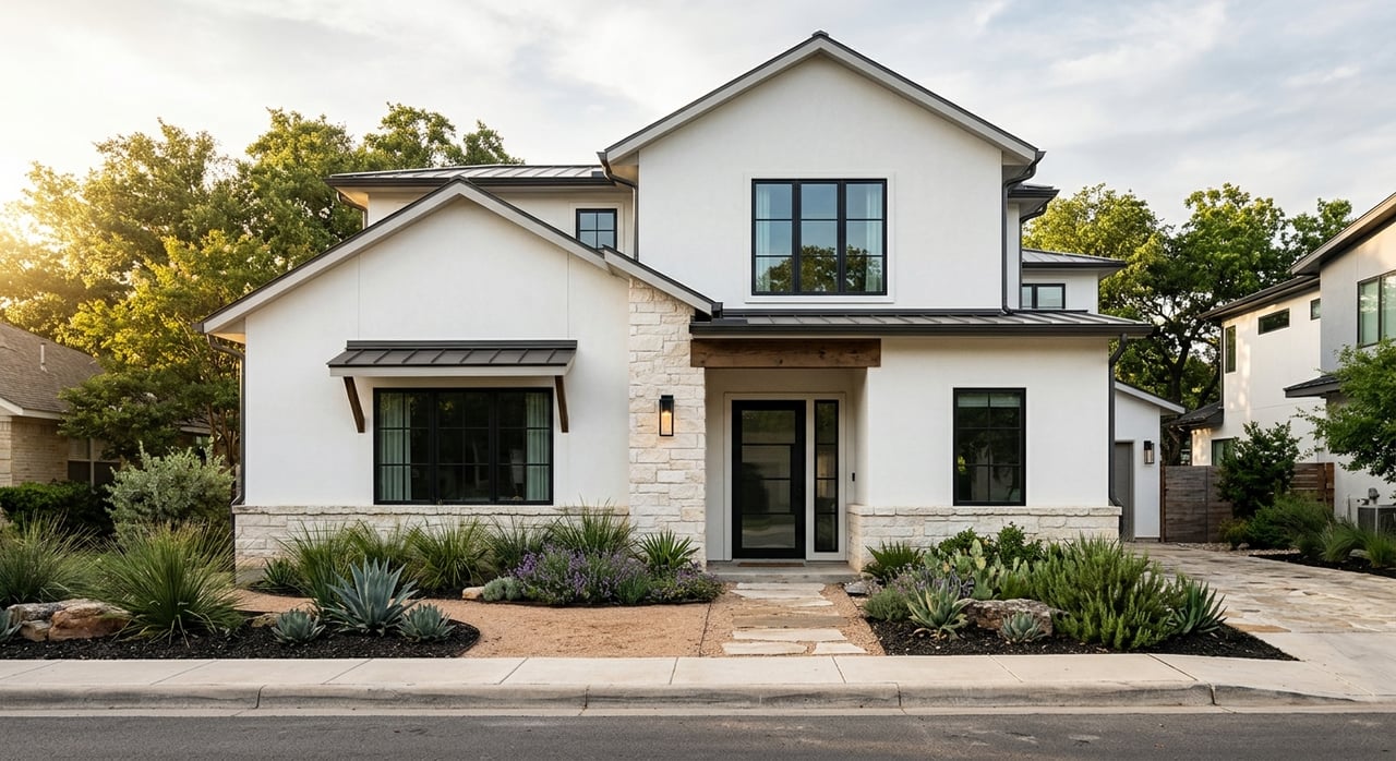
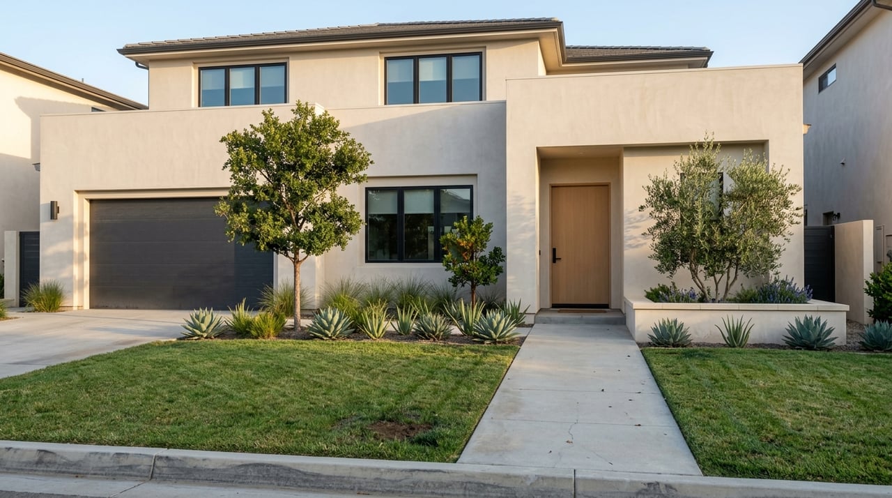
Looking for a home base that puts you close to these parks and trails? Reach out to The Harter Group for local guidance on neighborhoods, daily lifestyle, and homes that fit how you live.
Last verified: December 2025. Always confirm hours, parking, and permitted uses on the official pages before your visit.
FAQs
Which parks are within a 5–10 minute drive of Serrano Summit?
- Lake Forest Sports Park and Serrano Creek Park are typically within a short drive, with other community greens close by depending on your access point; check the City of Lake Forest pages at the City of Lake Forest site for the nearest options.
Where can I take a toddler for a 30–45 minute outing near Lake Forest?
- Choose a neighborhood or community park with a playground and a short paved loop, such as the Lake Forest Sports Park area, and verify restroom and hour details on the City of Lake Forest site.
What are good nearby hikes for a 2–3 hour outing from Serrano Summit?
- Consider loop options at Peters Canyon Regional Park, Whiting Ranch Wilderness Park, or Laguna Coast Wilderness Park; pick a signed loop that matches your pace and confirm current conditions at OC Parks.
Are there dog‑friendly trails close to Serrano Summit?
- Many regional paths and parks allow leashed dogs on designated trails, but rules vary by location; review dog policies on OC Parks and the City of Lake Forest site before you go.
Do any preserves require reservations or guided access?
- Yes, some Irvine Ranch Natural Landmarks areas use reservations or guided programs; review access details and event calendars with the Irvine Ranch Conservancy.
Where should I park on busy weekends?
- Arrive early, choose a trailhead with a larger lot when possible, and have a backup in mind; check the official park page the morning of your visit for any lot advisories.
Ready to live near these parks and trails? Connect with The Harter Group for hyperlocal guidance on Lake Forest neighborhoods and homes that fit your lifestyle.